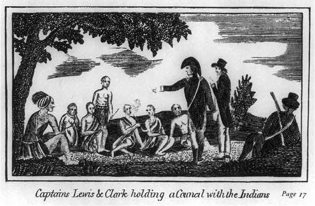
The Expedition met no Indians from the time they left the Mandan and Hidatsa villages until they made contact with Sacagawea’s people in mid-August 1805, near present-day Lemhi Pass on the Continental Divide. The captains kept a keen lookout for any sign of Native peoples during their long trip up the Missouri, but they saw no Indians and few signs of camps or activity.
In the Journals, conflicts with grizzly bears posed the most exciting episodes on the upper Missouri, but the most taxing to the Corps was the three-week portage around the Great Falls. The portage required building carriages for the canoes and dragging them seventeen miles across prickly pears, with mosquitoes biting continually, a pounding hailstorm, and a flash flood that nearly washed Clark off a cliff. Route finding had also posed problems, first at the Marias River,downstream from the Great Falls, and again above the Three Forks of the Missouri. At the Marias, the captains brilliantly analyzed river conditions and chose the Missouri over the Marias.
On the Beaverhead River above Three Forks, Sacagawea recognized a landmark from her youth, confirming that the Corps was near Shoshone territory. Knowing they could contact Shoshone Indians at any time, Lewis became apprehensive, because the Shoshone were his best chance to acquire horses to ferry the Corps over the mountains. He also worried about what kind of reception the Shoshone might offer. The Corps had not had contact with any Indians since leaving the Mandan Villages months before. In a sequence a novelist would hesitate to write, Lewis made contact with the chief of a Shoshone band and watched in amazement when Sacagawea recognized the man, Cameahwait, as her brother. That joyous reunion and the Shoshone’s desire for trade goods and weapons to protect them from enemies brought the needed horses.
The Corps had successfully traveled the length of the major river of the Louisiana Territory. They had established good relations with the Mandan and evaluated the commercial potential of the Missouri, hoping that the same would prevail on the Columbia. They could only hope that their relations with Native people on the trail ahead would be as successful and profitable.
On August 12, 1805, Lewis reached the headwaters of the Missouri River, strode across the upper-most trickle of that great river, and walked to the summit of the Continental Divide, “from which I discovered immence ranges of high mountains still to the West of us with their tops partially covered with snow.” He had expected to see a landscape that resembled the eastside of the Rockies. Instead he saw a forbidding scene with mountain upon mountain stretching into the distance. Just two days before, Lewis had written in his journal:
I do not beleive that the world can furnish an example of a river runing to the extent which the Missouri and Jefferson's rivers do through such a mountainous country and at the same time so navigable as they are. if the Columbia furnishes us such another example, a communication across the continent by water will be practicable and safe. but this I can scarcely hope from a knowledge of its having in it comparitively short course to the ocean the same number of feet to decend which the Missouri and Mississippi have from this point to the Gulph of Mexico.
Looking at the mountains, he knew that the geography he and Jefferson had mastered back at Monticello was faulty. The explorers had not found an easy portage between the two river systems. The Columbia did not bend to Jefferson’s wishes. As historian James Ronda put it: “Geography has a logic of its own, not necessarily amenable to presidential dreams and desires.” Lewis could not confirm a commercial link between east and west, and that stood as a failure that must have depressed Lewis at least momentarily.
Peering into the mountainous edge of the Columbia River Basin, Lewis knew the Corps had three important missions for the remainder of their trek to the Pacific, critical missions Jefferson had laid out in his instructions. First, they needed to map the region to add to the American claim to the Columbia River that originated with Robert Gray’s maritime exploration in 1792. Second, they planned to evaluate the potential of the Columbia as a conduit for commerce between the interior and the sea. Third, the captains had to establish friendly alliances with Indians for trade and future political relationships. What they would find on the Columbia were surprises in both physical geography and human geography.
Leaving Sacagawea’s people, the explorers rode north into the Bitterroot Valley with a Shoshone guide, who led them to a mountain trail that crossed the “immence ranges of mountains” Lewis had seen from the summit of the Continental Divide. On September 9, 1805, the guide, “Old Toby,” directed the Corps west up Lolo Creek, where it poured into the Bitterroot River. Two days later, the Corps followed what Lewis called “a fine bould clear runing stream” past abandoned Indian camps, up into the mountains, beginning ten days of game-poor traveling that tested the men’s strength. Along the route, they found very little to sustain them, but they saw signs of recent activity. On September 14, Clark recorded crossing a creek in the upper Lochsa River drainage: “a place the Tushepaws or Flat head Indians have made 2 wears across to Catch Sammon and have but latterly left the place.” At their camp that night, Clark reported that they had so little in their larder that they “were compelled to attack a Colt for our men & Selves to eat.”
© William L. Lang, 2004. Updated and revised by OHP staff, 2014.


